
Neighborhood Conservation, North 20th Street Style (Sept. 2013)
By Erik Meyers, resident, Lincoln & 20th Streets, North
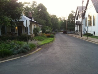
20th N. toward east from Monroe
|
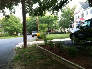
20th north toward west
|
Hosted by Joan Mashburn and led by Sena B. Wijesinha (Capital Projects Coordinator), a meeting on July 30 brought affected property owners up to date on plans for the Neighborhood Conservation Project slated for 20th Street between Kenmore and Monroe, North. The County sought residents’ feedback on a variety of project elements and reaction in general to their plans.
A primary goal of this NC project is to provide a sidewalk connection between new Kenmore and older Monroe Street sidewalks. Only a half block of 20th near Monroe (adjacent to Cherrydale Community Church) currently has a sidewalk. As is standard practice in NC projects, the County will completely replace the street. For this project, the work will also correct a major historic misalignment of County-owned right of way (ROW) and the actual street location at the intersection with Lincoln Street.
The current plan is for a street width of 22 feet to be maintained except for one small section between Kenmore and Lincoln where it would narrow to 20 feet, as a measure to protect a mature oak located on County ROW. Parking would be generally restricted to the south side of 20th where the new sidewalk is planned. Curb and gutter will be placed on the north side of 20th. Sidewalk width would vary between a minimum 4 feet up to a maximum of 7.5 feet, the latter including a 2.5 foot grass strip, and include handicapped access ramps at each corner (except at Monroe Street). The new walk would connect with the existing concrete sidewalk by Cherrydale Community Church.
County’s team detailed plans to replace water lines and storm drains under the street. Gas lines may also need to be replaced although several residents noted that a contractor had recently replaced the lateral lines along most of 20th. New storm drains would be placed on both sides of the street as well as on both sides of the Lincoln Street intersection. A total of six new street lights are planned. While the project is scheduled for 2014, no official starting date has yet been set. The county estimates it will take approximately six months to complete once underway.
Reaction from affected residents was generally favorable, and the County’s team agreed to look into a number of specific concerns that were raised. For example, the County agreed to look into parking alternatives, including the elimination of two or more spaces, on the south side of 20th at the intersection with Monroe. This intersection now experiences frequent turns and U-turns by Dunkin’ Donuts customers coming from nearby Lee Highway. (It was noted that both the new street sign post and 20th street stop sign are now askew after drivers collided with them.) One of the oldest homes in Cherrydale – built before 20th Street itself -- is located at this corner, and changes to the street that narrow any of the present minimal buffer space would increase risks to structure’s integrity and occupants’ safety. Other concerns raised included relocating two utility poles and the possibility new poles could obstruct new sidewalks. Subsequently, County staff clarified that, while they could not bar Verizon or Dominion from placing poles in the County ROW, utilities are required to maintain a minimum of 48 inches clearance on one side of any relocated pole to ensure passage on a new sidewalk.
Other concerns raised included proposed placement of several new storm drain openings. The County agreed to check into or make necessary modest adjustments to avoid problems. Staff also highlighted actions to save trees on County ROW and adjacent private property. Several trees will be removed, however, and another’s fate is uncertain. New entry cuts and grading will align private driveways with the newly replaced street. Limited parking with pervious paving is planned along two lots on 20th’s north side, allowing some continued use of the ROW and buffer. One final request raised by several residents concerned deferring construction of an accessible sidewalk stub on the NW corner of Lincoln. Since this element would not connect with any current sidewalk or plans for one in the immediate future, its addition would not increase accessibility for physically handicapped individuals and could therefore be deferred until such time as a Lincoln street sidewalk is planned. Funds might be reused to provide handicapped access at the Monroe intersection where none currently exists.
Several residents raised the need for additional traffic control signage. Specifically, four way stop signs at the 20th and Kenmore intersection and a “No U-Turn” sign for Monroe and 20th would increase safety for pedestrians and property. The steep slope on 20th for motorists coming up hill from Johnson prevents clear sightlines of pedestrians crossing at the intersection, a potential hazard with the new crossing at Kenmore and 20th Street. At the other end, increasingly frequent U-turns at Monroe and 20th create unnecessary hazards as well. NC staff does not control placement of traffic signs, but staff agreed to provide the proper contacts for residents to pursue these concerns.
Stay alert for future updates on this NC project. The earliest likely start date was projected as late April 2014.